Day 0: Arrival
I arrived first in Salt Lake City on Saturday the 18th, checked into the room at the airport hotel (rooms help for sorting gear), and drove the rental car to the nearby REI and grocery store to pick up gear and food. (They had ball-nuts! I'd never seen a ball nut before!) The only gear that we really needed was matches and fuel, these items being difficult to legally transport by air nowadays. I made the mistake of getting the cheap matches at REI. Don't do that!
After Dave arrived in SLC, I took him out to a nearby Mexican place, Taqueira Acapulco, which was highly recommended by the Internet. Then we went back to the room to start sorting gear and to get some rest before the 6-hour drive the next day.
Day 1, part 1: Drive to the Grand
Salt Lake City has a lot of cragging, but it does not have 13,000-foot mountains. After breakfast and dragging the backpacks out to the car again, we started driving north to Wyoming, a state that neither of us had visited before, through Idaho, another previously-unvisited state. While I find a 6 hour drive pretty long, being impatient and all, the scenery did contain spectacular and new-to-me plains. Sure beats the 401!
After a gas stop and a short visit to a large army-surplus store, we arrived in Jackson, WY. We knew we'd have to get an overnight-use permit for Grand Teton National Park at the Jenny Lake ranger station, and that they close at 5:00. But first we stopped at a sports store in search of better maps and lip balm, since we didn't think these would be available inside the park. In retrospect, we would have been better off at the store inside the park for several reasons. We left the store with lip balm and the information that the guy working at the store had been to Amphitheatre Lake.
While continuing to drive towards Jenny Lake, I had Dave call the ranger station, which resulted in some useful beta. We also learned that we had a chance of getting there before they closed. After paying the park entrance fee, we arrived at Jenny Lake, parked the car, and arrived at the ranger station at 5:01. So we stood around the closed door looking sad. Apparently our tactic worked, as the last remaining ranger kindly issued us a permit enabling us to stay at the Moraines. After leaving our route information with Dave's girlfriend, we drove to the trailhead and started hiking right away.
In retrospect, here are two things that we should've done before starting to hike. I highly recommend them.
(1) remove excess food from packs; and
(2) check the map for the route.
In fairness, (2) was a bit more difficult that it seemed, since none of the maps available to us contained dotted lines containing the climber's trail to the high camps. That's partly why we had stopped at the sports store earlier.
Day 1, part 2: Hike
In the parking lot, we encountered another party which was climbing Mt. Owen. They mentioned that they'd be on the trail with us until they took a different turn at some point.
We started hiking. Given our excessive loads, we didn't really hike that fast. However, we didn't look at any directions either. We eventually reached a sign for Amphitheatre Lake vs. Garnet Canyon. Like chumps, we took the turn for the place that someone had mentioned earlier, and figured that we would reach the end of the trail and continue hiking (as we did at Mt. Rainier previously). In particular, we had not studiously memorized the directions for the approach, which never really make sense anyway until you're enroute.
As expected, we eventually reached Amphitheatre Lake (at dusk) and hiked off into the woods. We continued hiking. Past two pitons. Also, there was some fourth-class downclimbing. I didn't remember anything about that from the guidebook.
An hour and a half after leaving Amphitheatre Lake it was getting quite dark, and the terrain was bouldery. At some point I felt something fall across my legs, but I couldn't figure out what it was, so I ignored it. Eventually we gave up and set up our tent on a small snowpatch---better than boulders! When I tried to take a picture of our tent site, I noticed that the something was, in fact, my camera. Oops.
Day 2: Undo negative progress. Reach high camp.
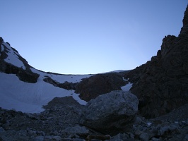
Some hours later, nature called and I took advantage of the opportunity to take some pictures with Dave's camera ($50, by the way, but not nearly as nice as the Canon which fell down a hole.) Note Delta Lake below and to the left on that picture.
Of course, 6am is too early to actually be up when not attempting an alpine start (and still feels too early even when trying an alpine start). Even when the sleeping situation is like sleeping on a non-lie-flat airplane seat. So I went back to bed and got up a bit later.
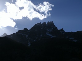
I later found out that the peak outside our window was Disappointment Peak. Aptly named. How did I find out that I was going the wrong way? Well, I encountered the party from yesterday evening. Who I should not have encountered, since they were supposed to be going somewhere else. OK, so we were in the wrong canyon. We saw three options: 1) hope for a notch in the wall and traverse over to the correct canyon; 2) backtrack and take the correct turnoff; 3) cross over the scree, get to Delta Lake, and get back on the trail there.
We chose door #3. It turned out to be a bad idea. The scree turned out to be unstable and crossing over the scree was not fun at all. Nor were the marshes at the edge of Delta Lake. In fact, we had to go around the lake, as our initial direction was blocked by cliffs and water. Didn't seem like fun to climb. But we did pop back onto the trail, encountering a day hiker with a book full of day-hikes. The trail was quite welcome after the narrow climber-trail-like trail. This time, I carefully read the book for hints about which way to go. Reading was, in retrospect, unnecessary; if you just take that one turn correctly, then navigation to our high camp, the Moraine, and beyond to the Lower Saddle, is pretty much as difficult as navigation on the Appalachian Trail.
(In retrospect, I think that #2, backtracking, would have been better. We knew how that went. #1 would have been risky; our topos weren't great at indicating cliffs. Consulting the book later suggests that it would have gone, but who knows?)
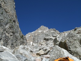
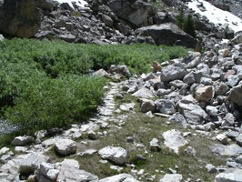
About seven hours later, we arrive at the Moraine after hiking in excellent weather all day. The hardest part of the hike was the boulders just after the Platforms; they involved some bouldering and a couple of steps on snow. As seen in the picture, the trail was extremely straightforward, but did gain a couple of thousand feet of elevation. Along the way, we did some turtle racing with another overencumbered party. Finally, we set up our tent again on the rocks. We'd finally arrived at 11,000 feet, leaving us 2,700 feet from the summit. A good occasion to eat some of the Mountain House dehydrated food.
I sure felt that my pack was too heavy. I think there is a certain threshold for pack weight: less, and walking works fine. More, and walking is terribly painful. I tried to foist some of the food in the summit pack onto Dave, but it came back to me after a few hours.
Interlude: Some thoughts about guidebooks
The current guidebook contains 415 pages. I'm not the kind of chump who lugs 415 pages of guidebook up a mountain when about 10 of the pages are relevant to my climb! The old book was much more pocket-sized, but I wasn't exactly going to take that up the mountain. Photocopy machines help. But they only help if you read the text. There's still the TMI problem.
We also felt like the guidebook was quite good at corroborating where we had been already, but was significantly less useful at telling us where to go next.

-
0426_keys_check
3878 visits

-
0426_aveo
3963 visits

-
0428_dramatic_grand_shot
3350 visits
-
0429_morning_view_from_bivy_site
3452 visits

-
0431_towards_garnet_canyon
3150 visits

-
0435_dave_packing_up
3553 visits

-
0436_taking_down_tent_on_snow
3305 visits

-
0437_disappointment_peak
3192 visits
-
0439_plenty_of_water
3264 visits

-
0440_dave_pondering_lake
3195 visits

-
0438_plam_with_delta_lake
3263 visits
-
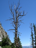
0450_dead_tree
5803 visits
-
0451_back_on_path
3319 visits

-
0453_correct_sign
3510 visits

-
0456_dave_and_others
3328 visits

-
0457_paving_stones
3543 visits
-
0459_running_water
3334 visits

-
0461_plam_hanging_out
3078 visits

-
0463_meadow_or_chopper_landing_site
3248 visits

-
0465_the_caves
3296 visits

-
0466_middle_teton_and_meadow
2865 visits

-
0467_snowfields_and_meadows
2751 visits

-
0471_falls
3473 visits

-
0472_snowfields
2836 visits

-
0473_scenery
2903 visits

-
0474_flatland_view
2769 visits

-
0475_dave
3753 visits

-
0476_alpine_flowers
3288 visits

-
0477_summits
2978 visits

-
0480_dave_crossing_snow
2997 visits

-
0481_dave_in_shadows
3399 visits

-
0483_sunset_view
3005 visits

-
0484_towards_lower_saddle
3408 visits
